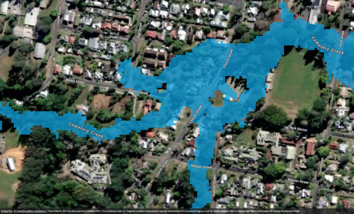
Bellingen Large-Scale Flood Mapping
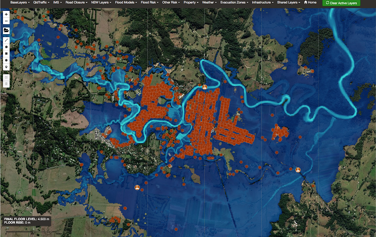
Bellingen Shire Council has taken a proactive step in flood … Continued
Bellingen Shire Council has taken a proactive step in flood … Continued
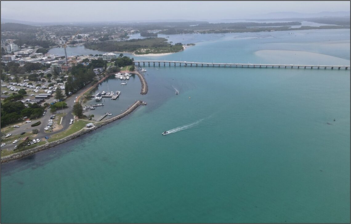
JB Pacific successfully delivered the Coastal Management Program Stage 2 … Continued

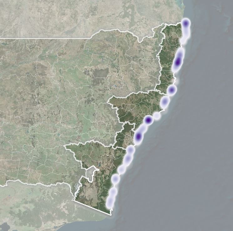
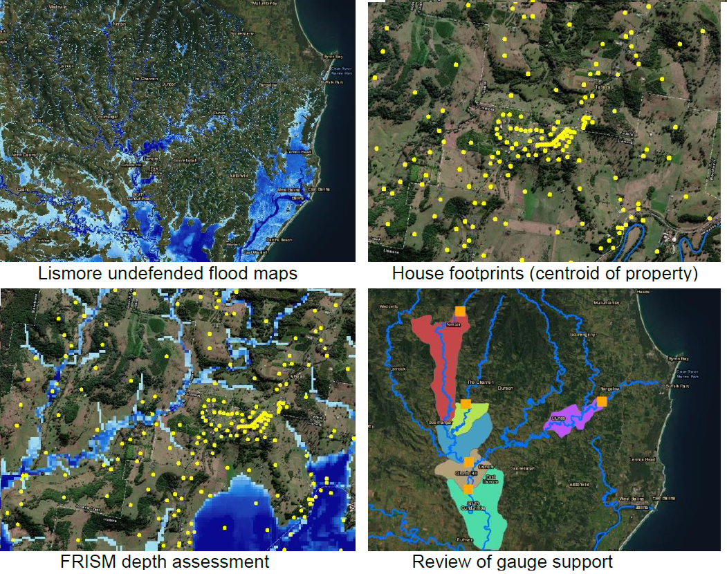
Between February and March 2022, the Northern NSW region experienced … Continued
New South Wales (NSW) Department of Planning, Housing and Infrastructure … Continued

The Moonee catchment is located 13km north of Coffs Harbour … Continued
The Byron Shire Council commissioned JB Pacific to undertake a … Continued
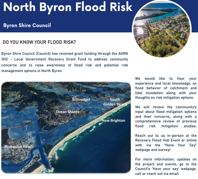
The Byron Shire has recently experienced widespread flooding, in particular … Continued
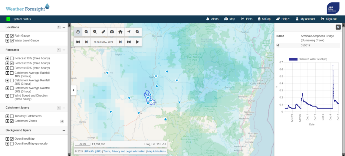
The City of Armidale is located on the Dumaresq Creek … Continued
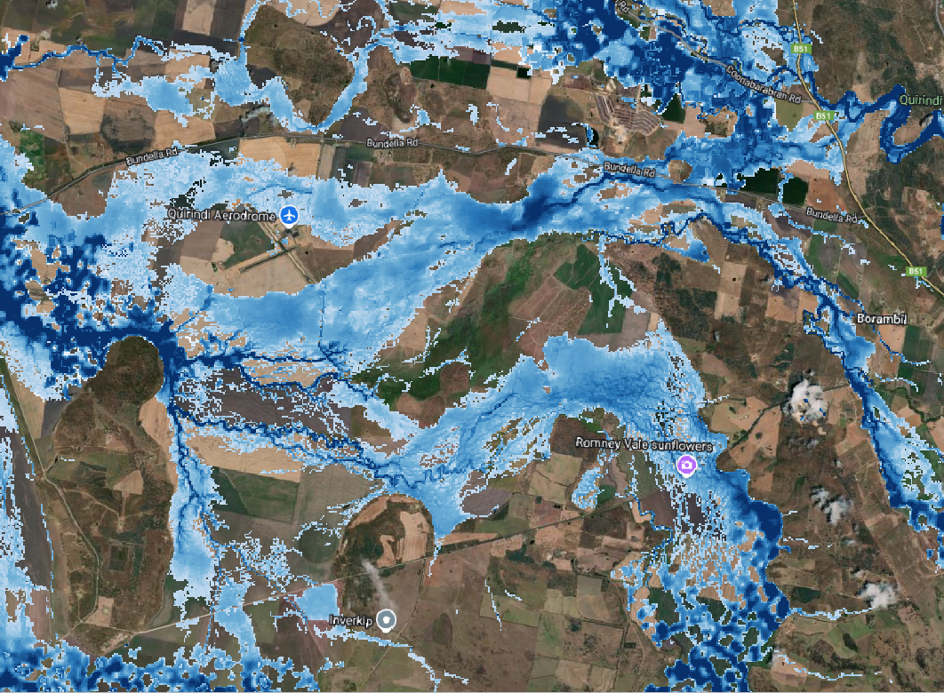
The Liverpool Plains Shire is located in the North West … Continued
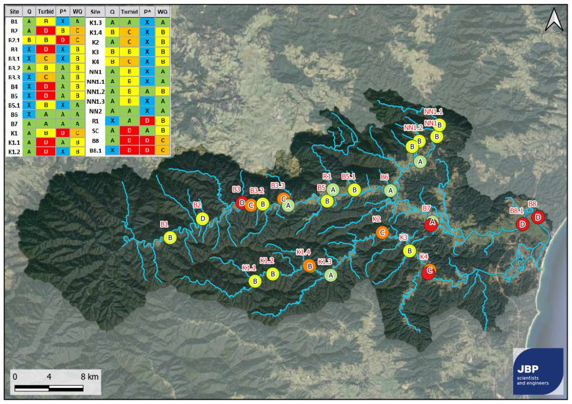
The Bellinger-Kalang catchment is located on Gumbaynggirr Country in the … Continued
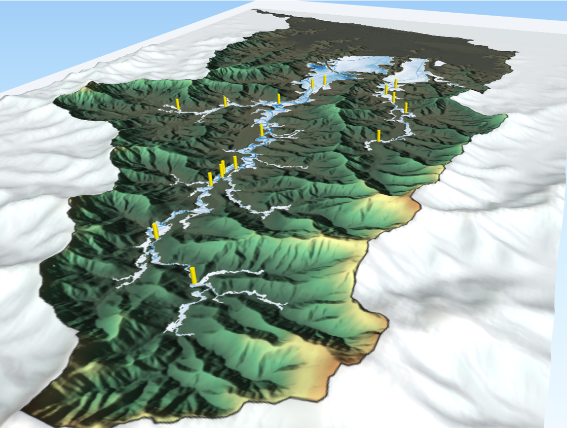
JBPacific undertook new hydrology and flood modelling, risk assessments, trigger … Continued
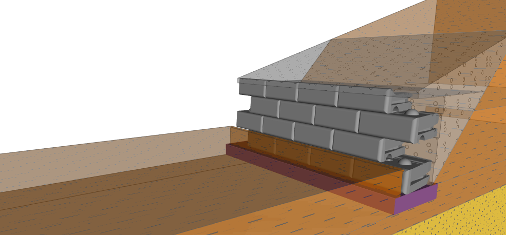
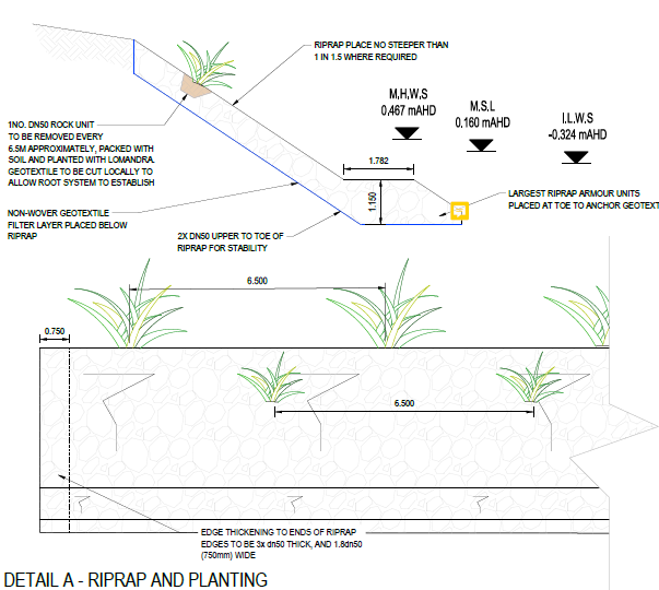
Waterway engineering design of erosion protection on the Macleay River, … Continued
A detailed design project for flood levee remediation works. The … Continued
This project predicted changes to waterway hydrodynamics, salinity and bed … Continued
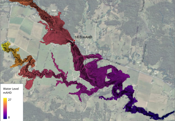
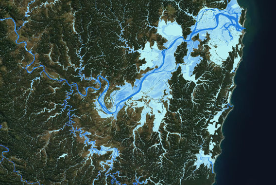
Large-scale flood modelling and mapping now at 5m resolution for … Continued
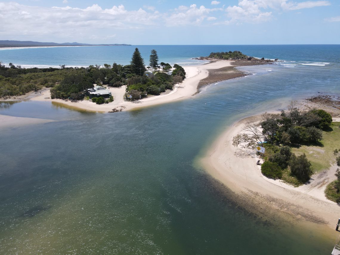
A detailed assessment of estuary hydrodynamics for these two coastal … Continued
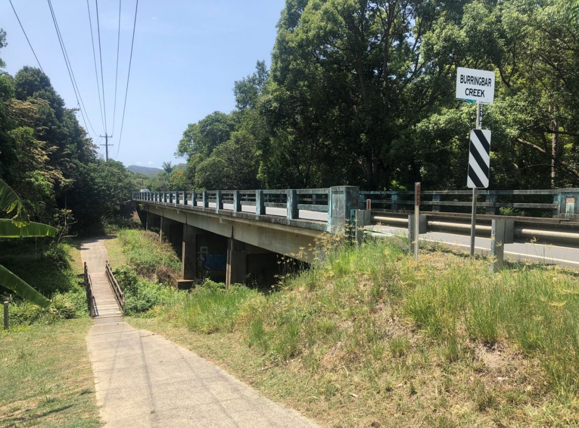
Hydraulic modelling of a railway embankment failure scenario within Burringbar … Continued
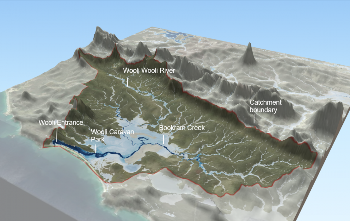
New hydrology and flood risk study for the Wooli River … Continued
A hydrological modelling (URBS) and design flood estimation project in … Continued
This project developed business case justification for new flood infrastructure … Continued
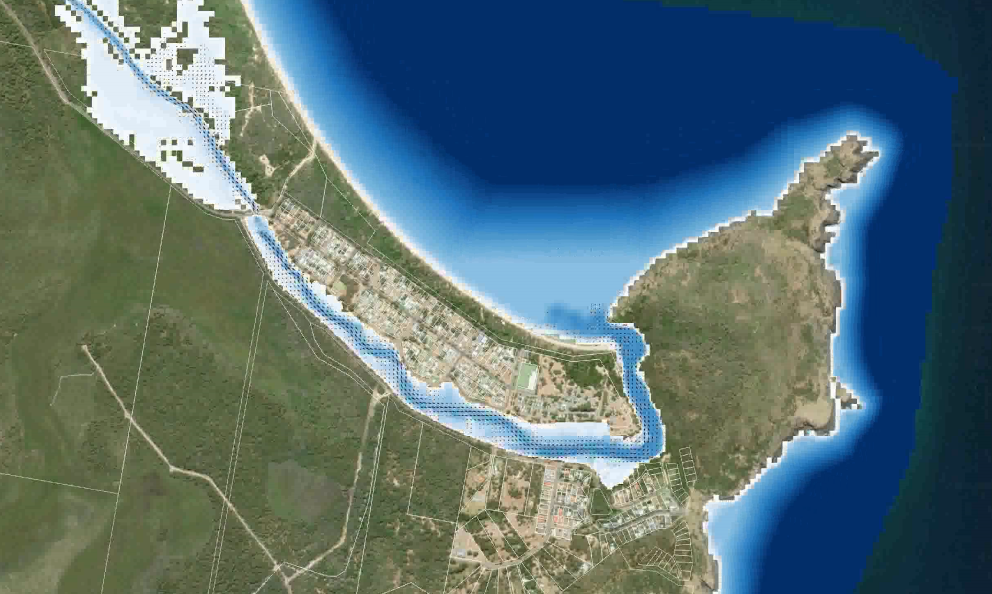
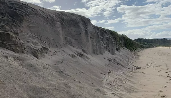
New Coastal Vulnerability Area (CVA) mapping under the NSW coastal … Continued
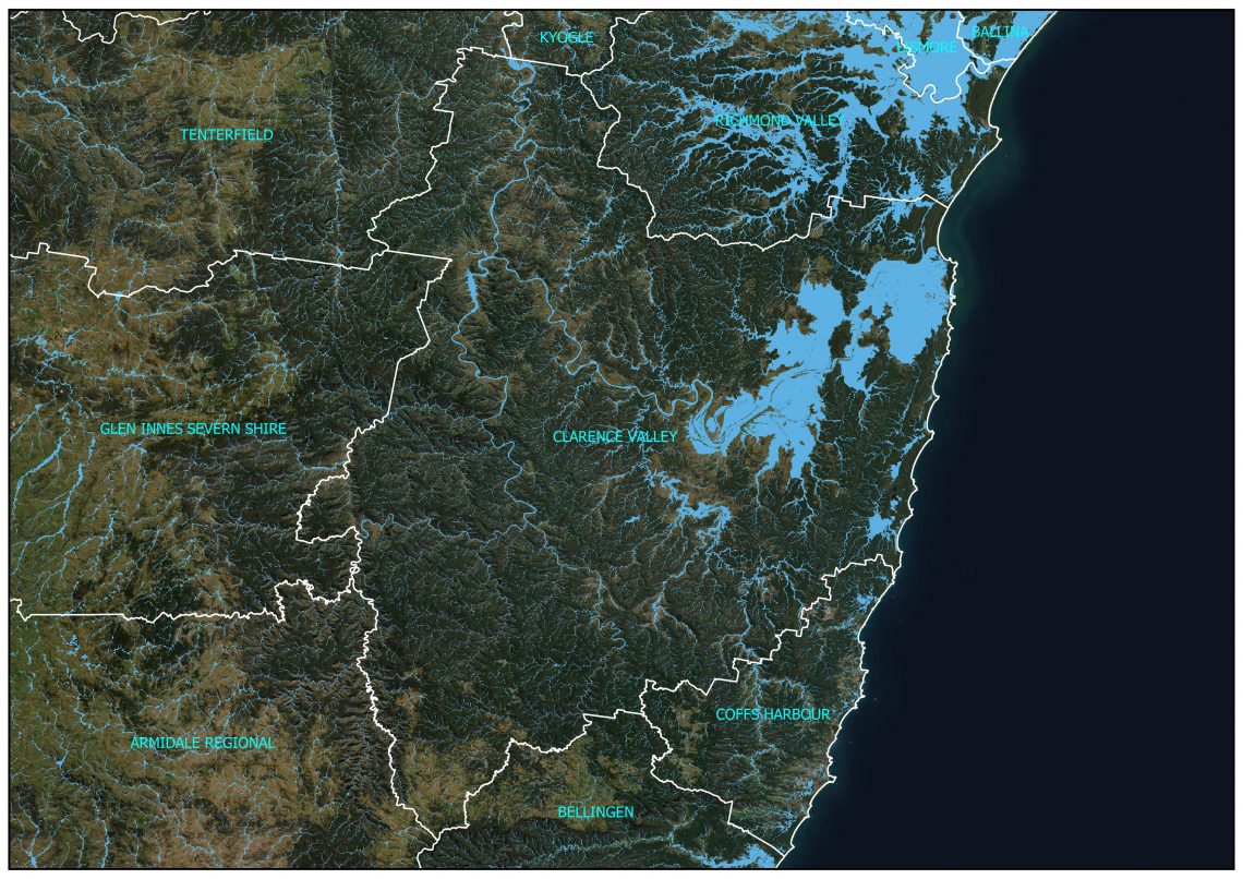
Large scale flood mapping throughout the Clarence Valley Council region, … Continued
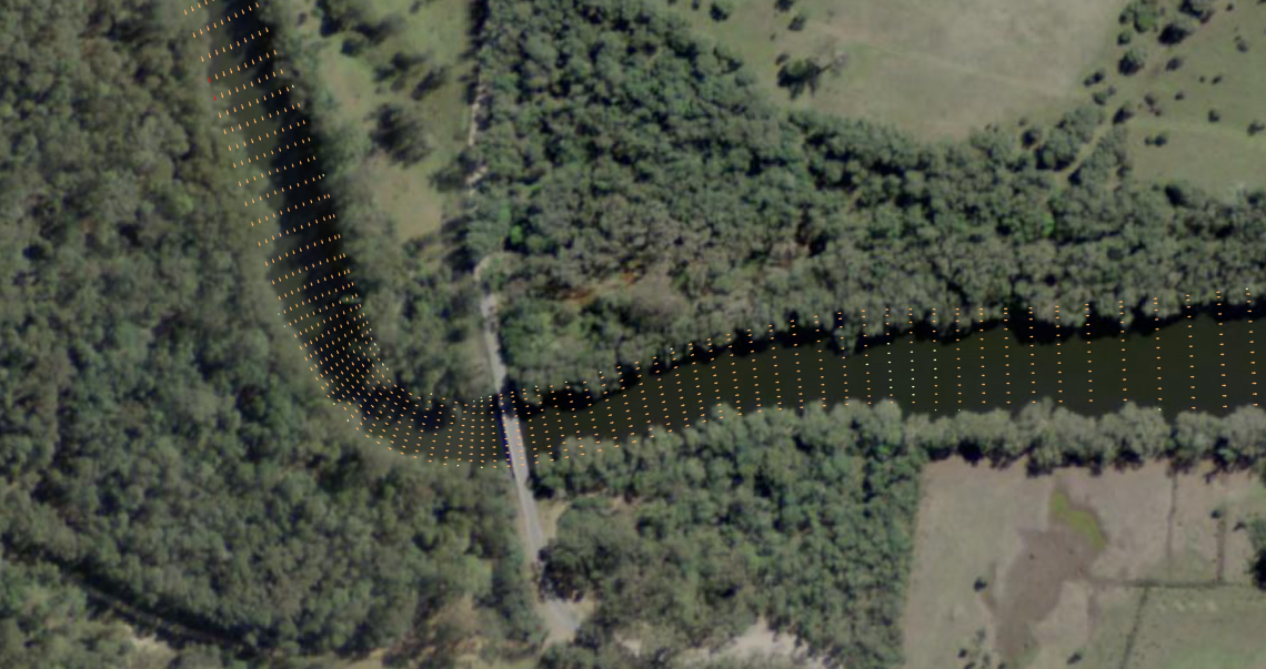
Jayden Kachel (Southern Cross University) investigated the accretion occuring at … Continued