Flood risk management for Vientiane and Pakxan City in Lao PDR
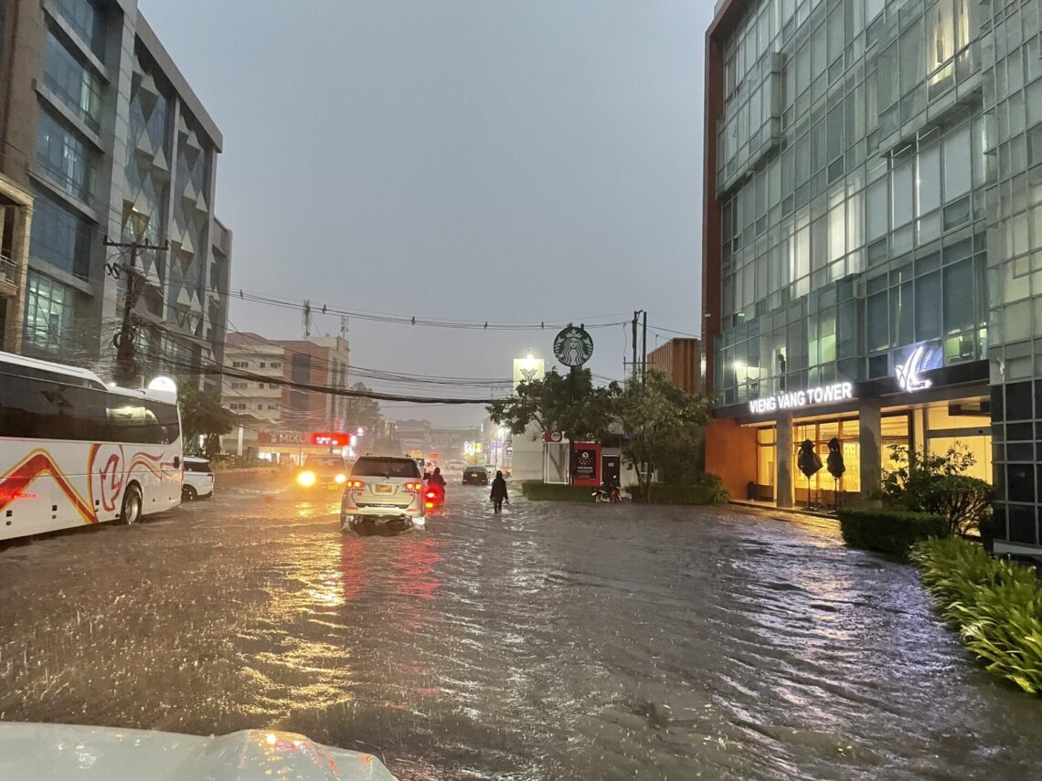
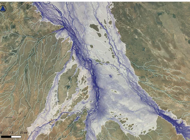
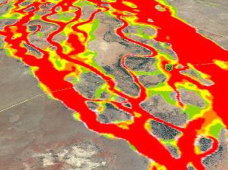
The challenge Vientiane capital city and Pakxan city are two … Continued
The challenge Vientiane capital city and Pakxan city are two … Continued
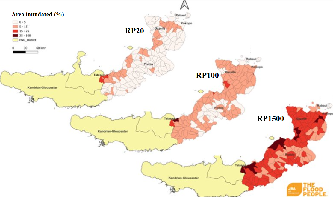
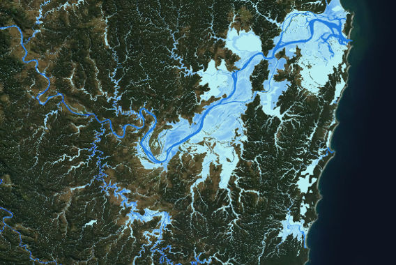
The challenge Papua New Guinea (PNG) faces significant challenges in … Continued
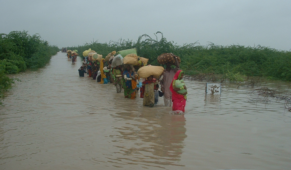
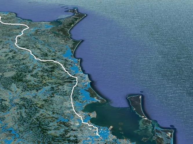
The challenge The Sindh Delta in southern Pakistan faces severe … Continued
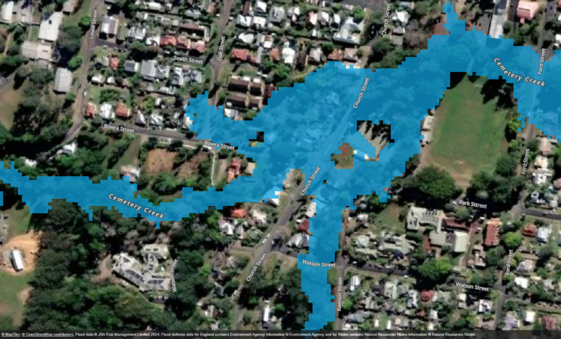
Bellingen Shire Council has taken a proactive step in flood … Continued
JB Pacific successfully delivered the Coastal Management Program Stage 2 … Continued

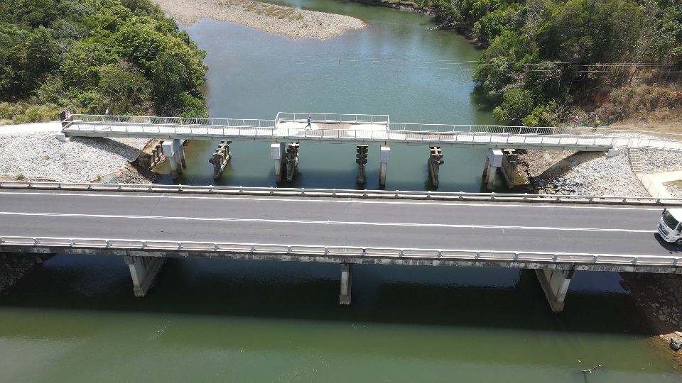
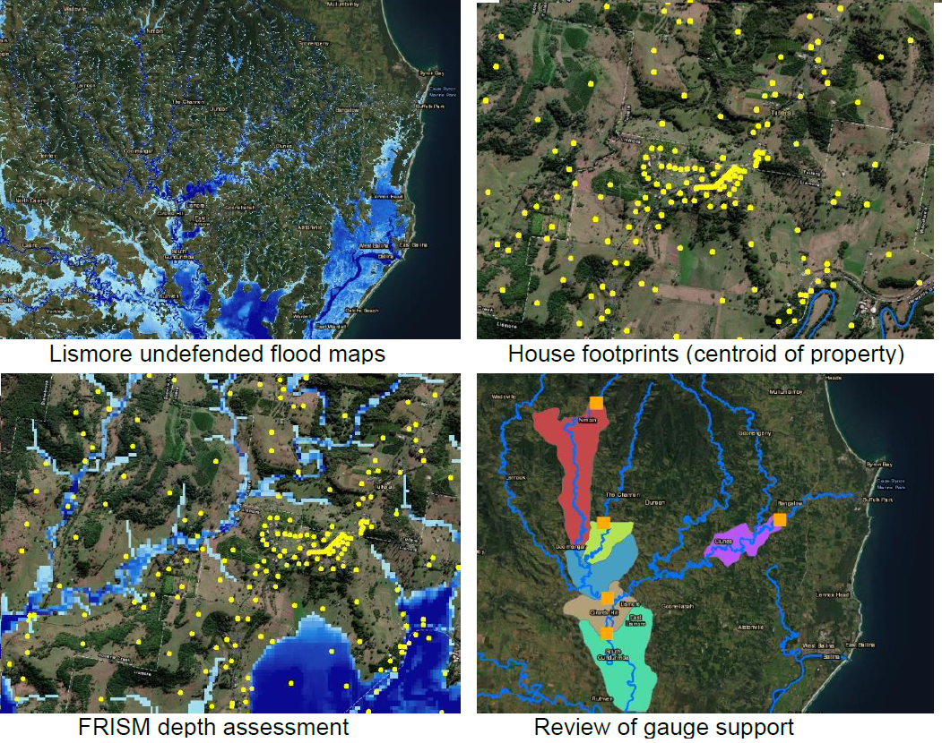
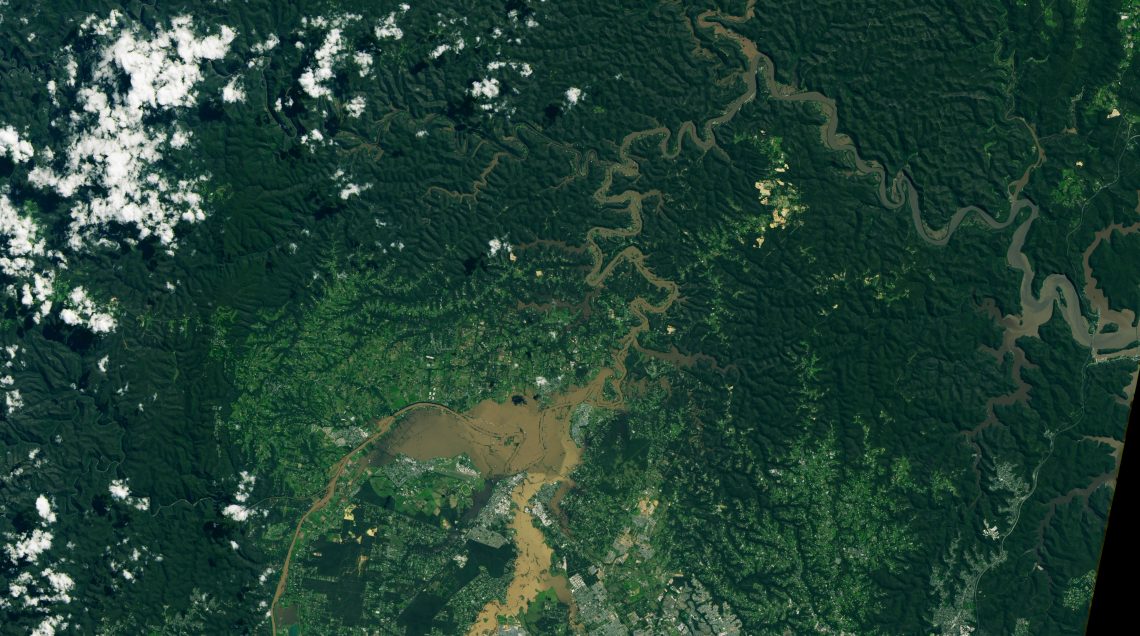
Between February and March 2022, the Northern NSW region experienced … Continued

The Moonee catchment is located 13km north of Coffs Harbour … Continued
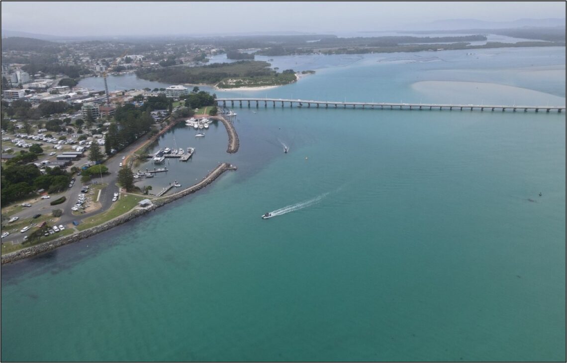
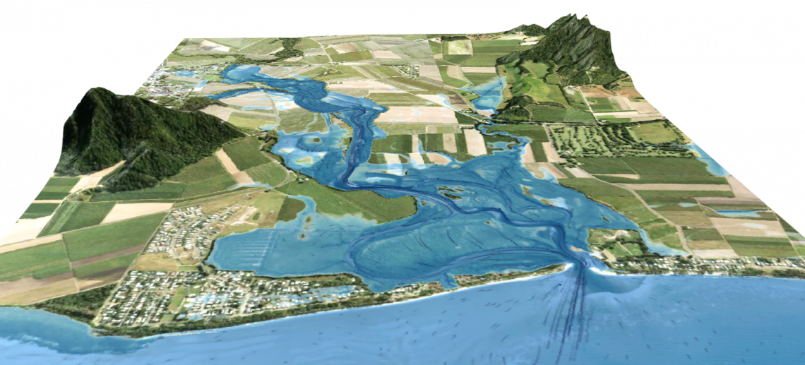
The Byron Shire Council commissioned JB Pacific to undertake a … Continued
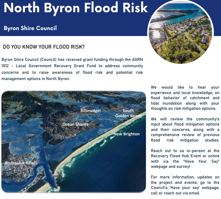
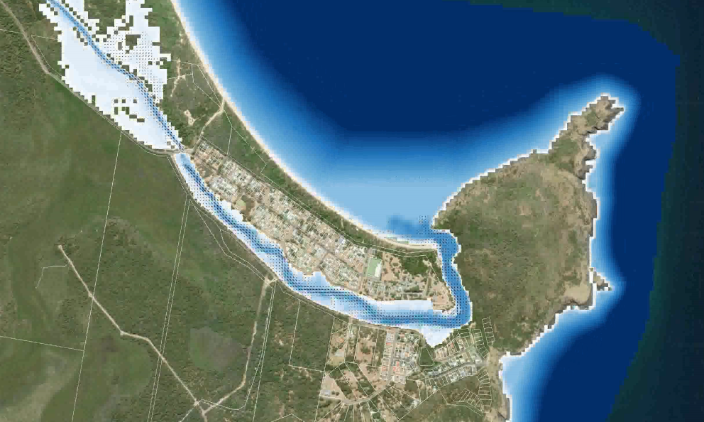
The Byron Shire has recently experienced widespread flooding, in particular … Continued
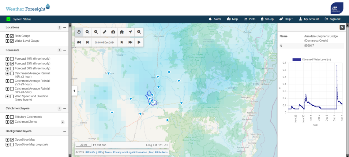
The City of Armidale is located on the Dumaresq Creek … Continued
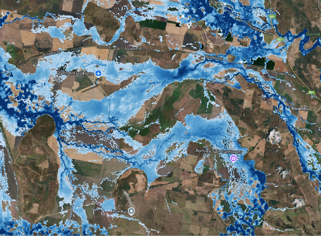
The Liverpool Plains Shire is located in the North West … Continued
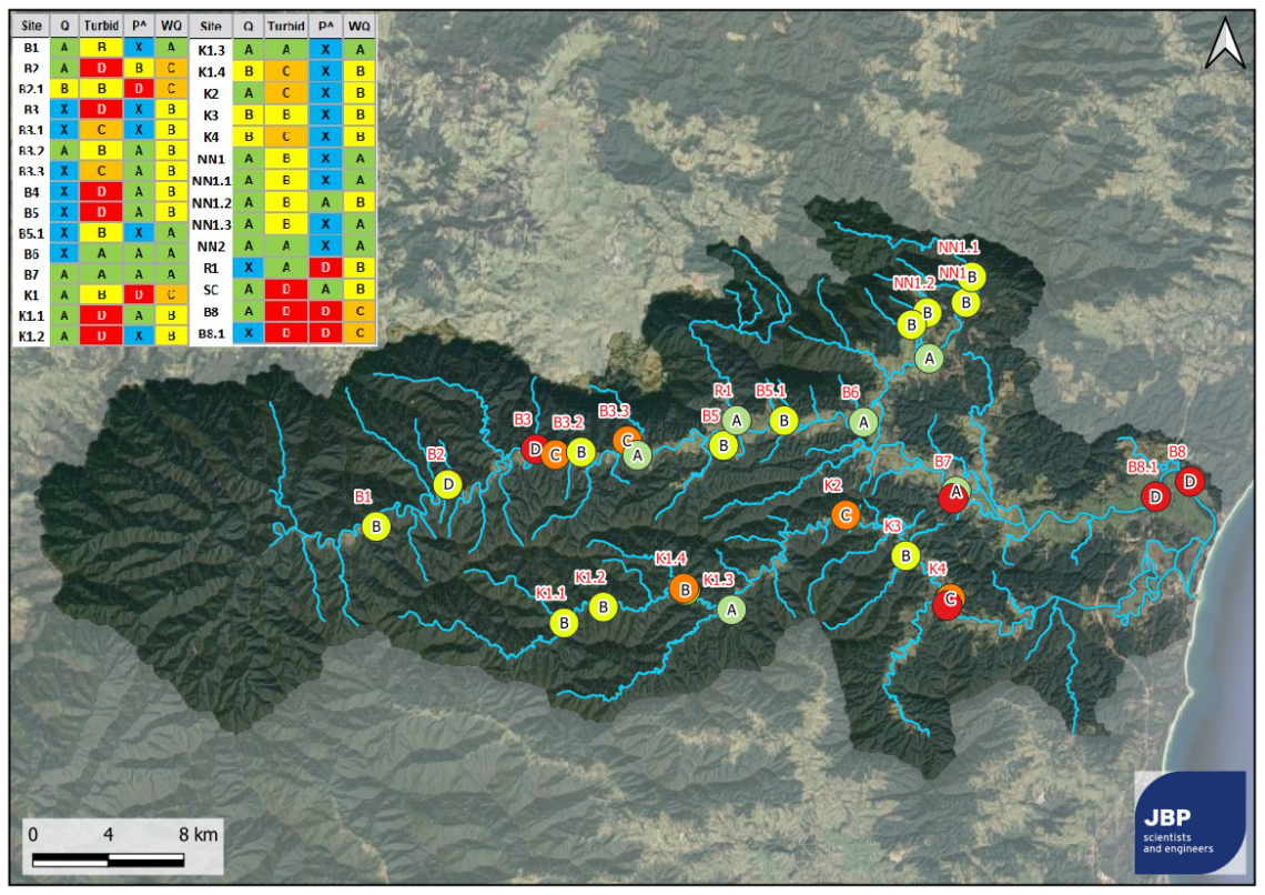
The Bellinger-Kalang catchment is located on Gumbaynggirr Country in the … Continued
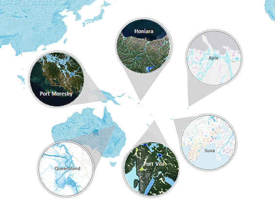
The challenge The Pacific region faces significant risks from natural … Continued
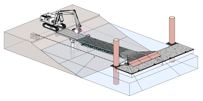
The challenge The design and management of marine structures can … Continued
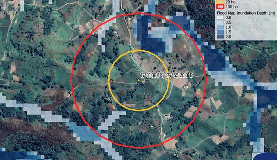
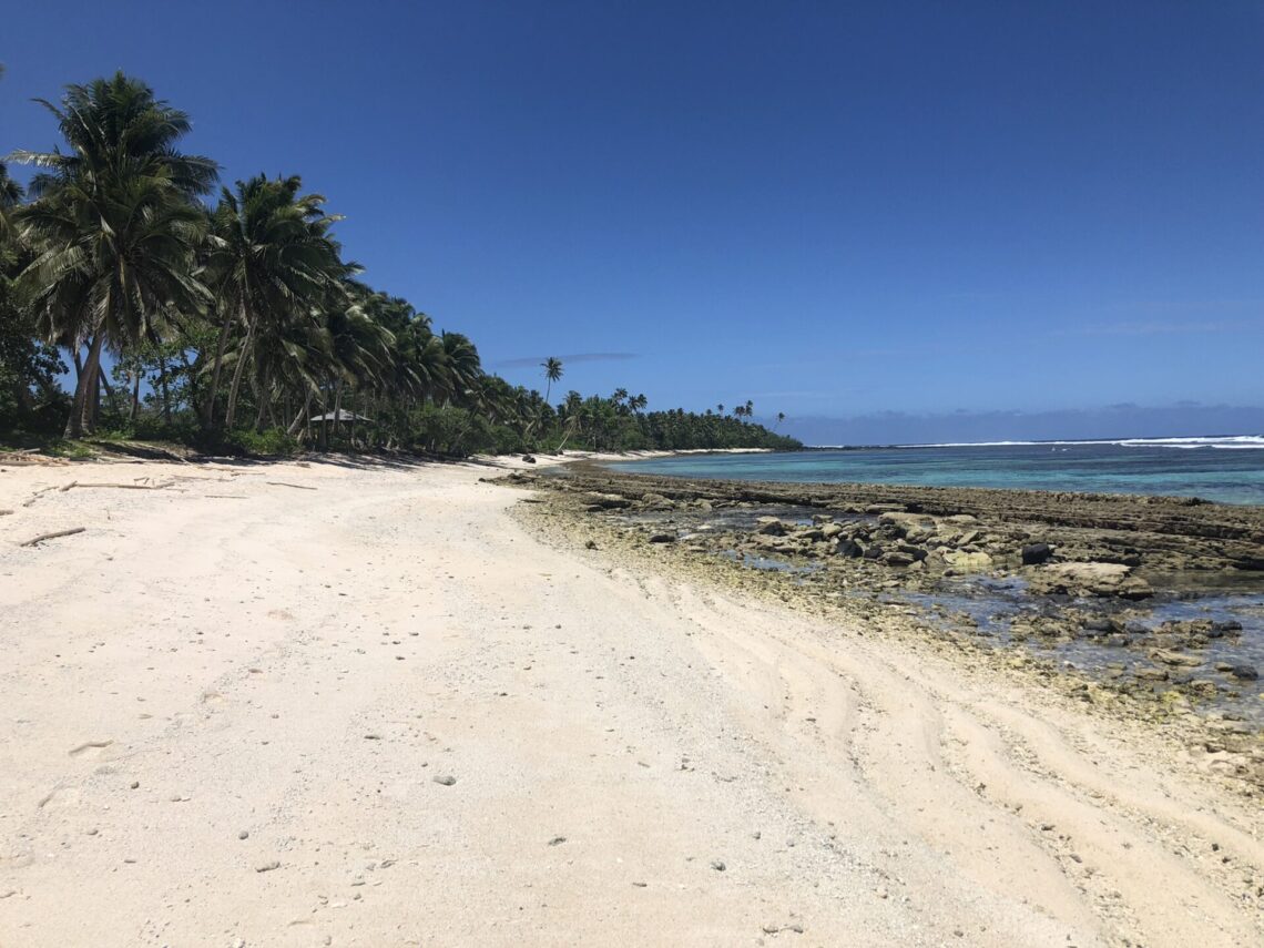
An island-wide flood risk assessment targeting seven potential sites for … Continued
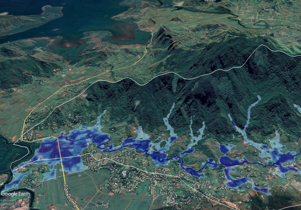
A project delivered under the Global Climate Change Alliance Plus … Continued
This project predicted changes to waterway hydrodynamics, salinity and bed … Continued
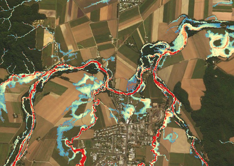
Large-scale flood modelling and mapping now at 5m resolution for … Continued

A very-large scale flood risk assessment for the Cairns region. … Continued
A large-scale hydrologic assessment, flood study and infrastructure assessment within … Continued
JBP is a custodian of the Australian Flood Map – … Continued
A detailed assessment of estuary hydrodynamics for these two coastal … Continued
A detailed hydrologic assessment and flood study for the Mossman … Continued
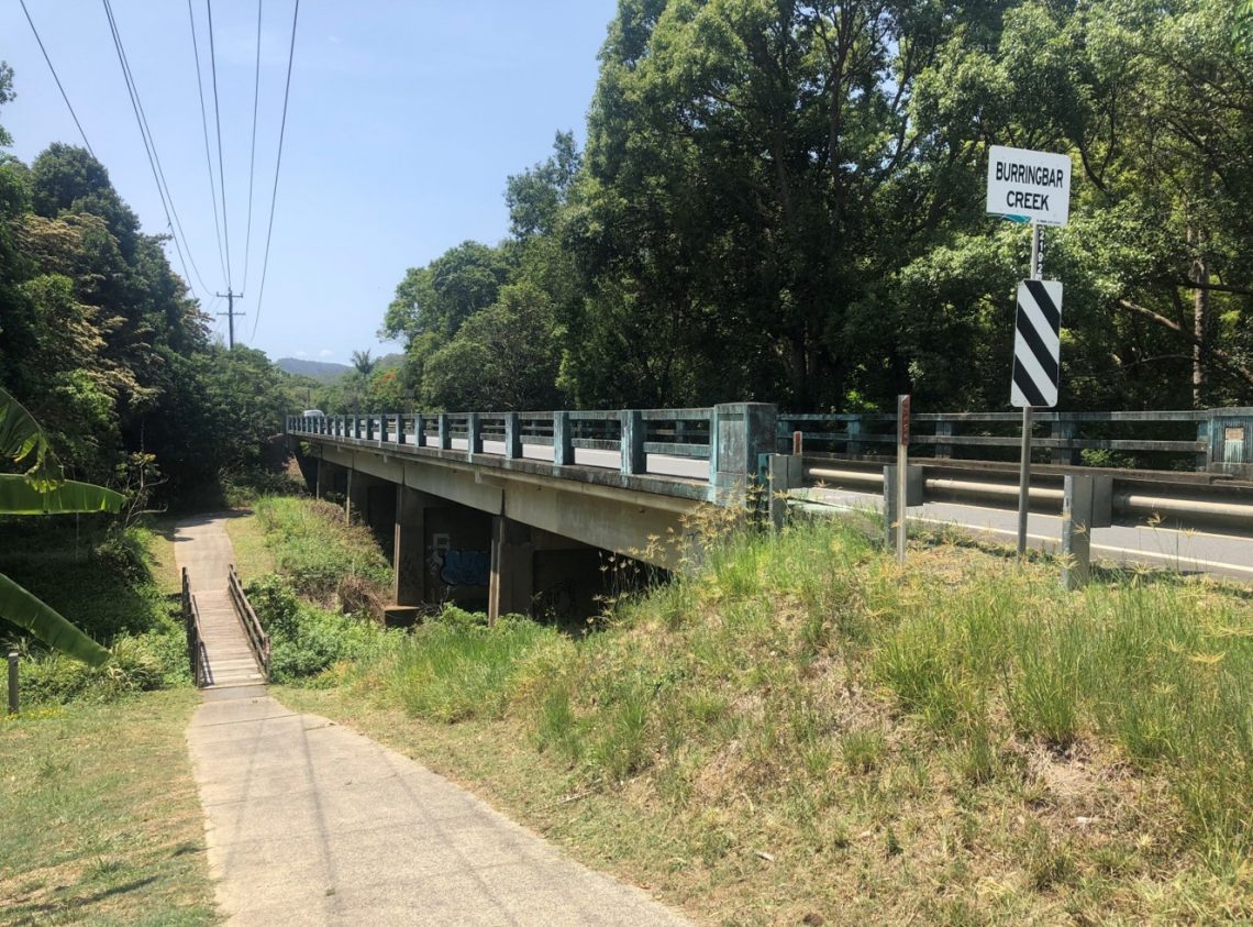
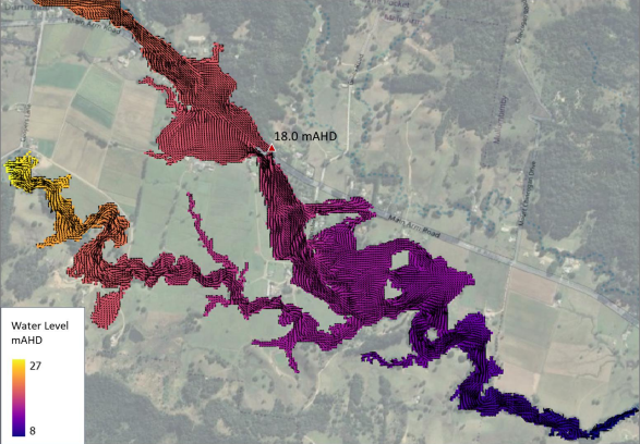
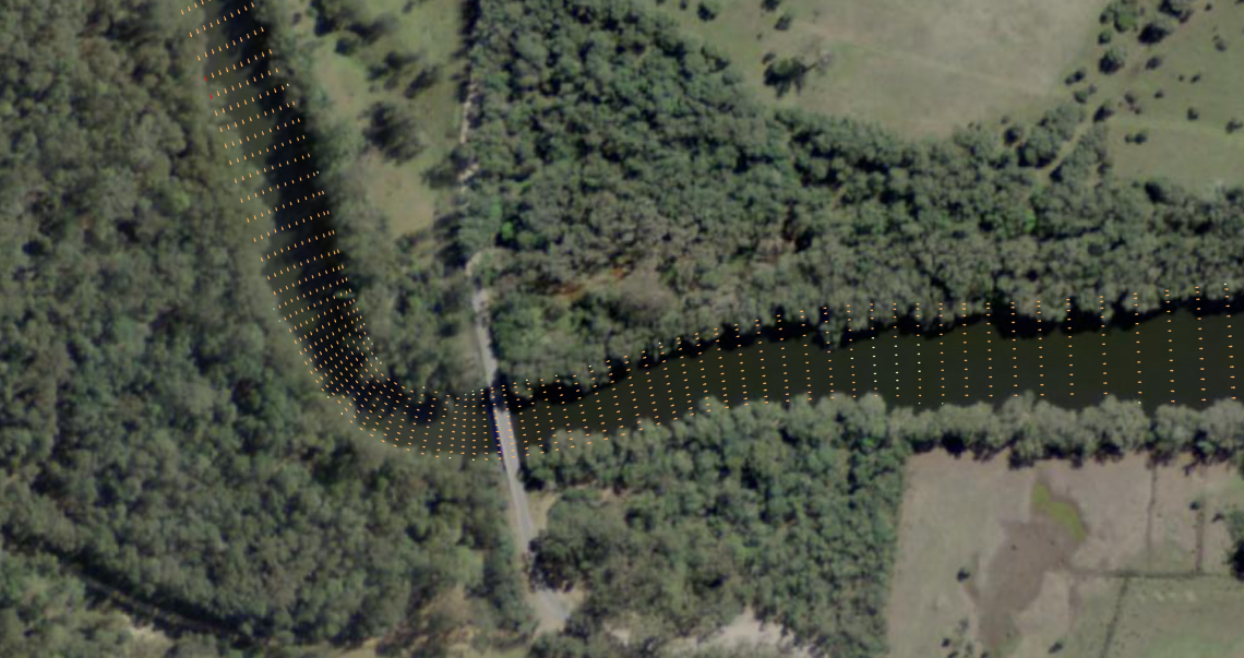
Hydraulic modelling of a railway embankment failure scenario within Burringbar … Continued
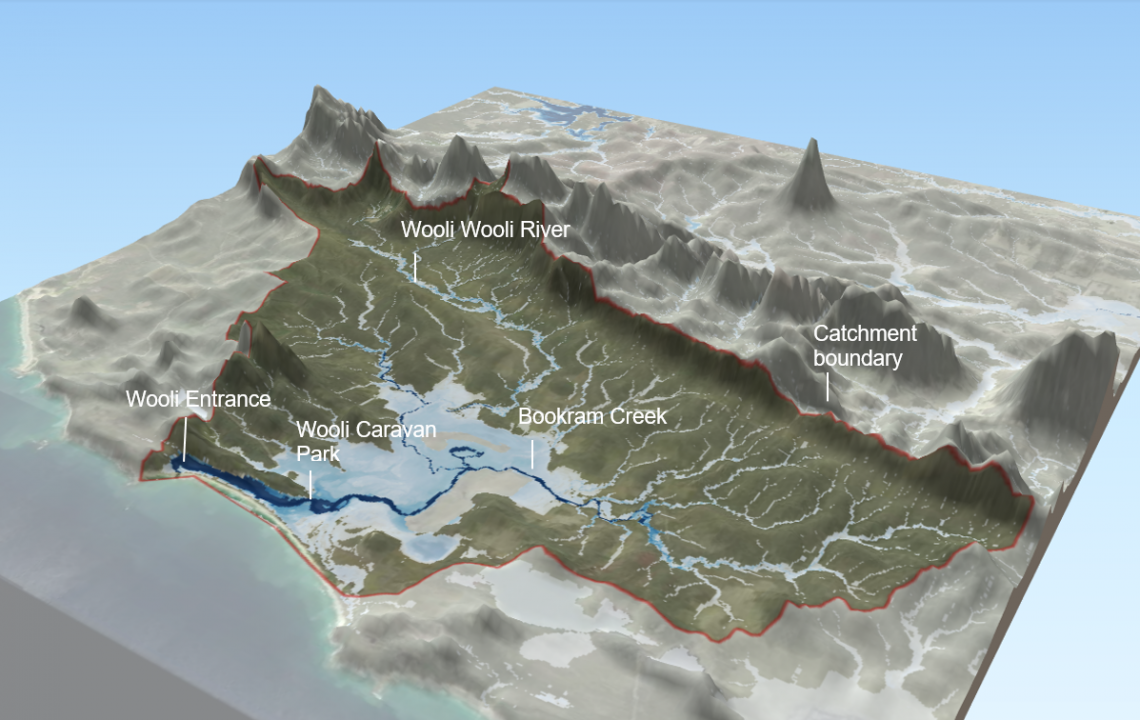
New hydrology and flood risk study for the Wooli River … Continued
A hydrological modelling (URBS) and design flood estimation project in … Continued
A catchment-wide hydrology and flood study was undertaken throughout the … Continued
This project developed business case justification for new flood infrastructure … Continued
A broad scale hydrology and flood mapping project to perform … Continued
New Coastal Vulnerability Area (CVA) mapping under the NSW coastal … Continued
Hydrology assessments for the NSW March 2021 floods. This included … Continued
A large-scale flood study including hydrologic and hydraulic modelling, applying … Continued
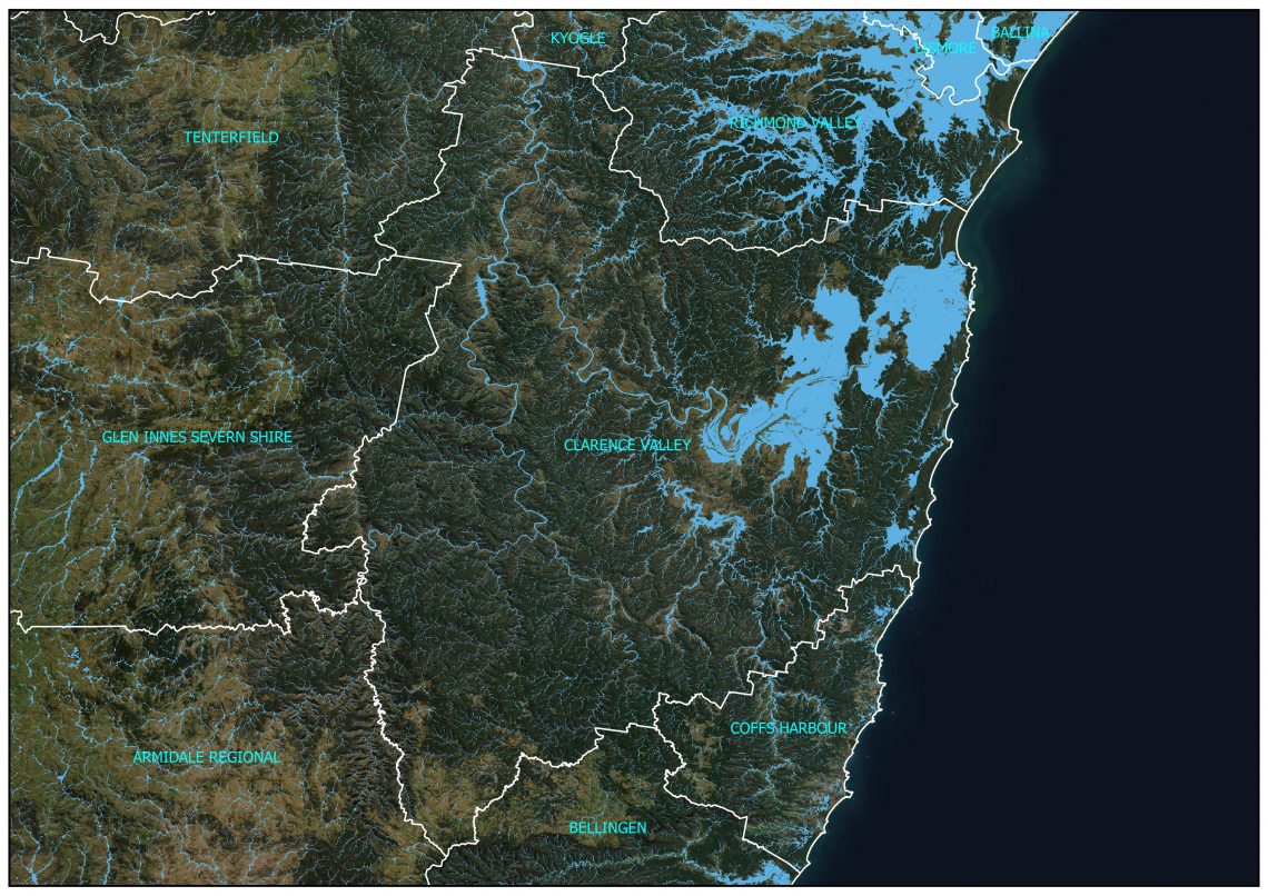
Large scale flood mapping throughout the Clarence Valley Council region, … Continued
A large scale assessment of hydrology and flood risk along … Continued
Our Pacific Island Flood Maps have been developed since 2014 … Continued
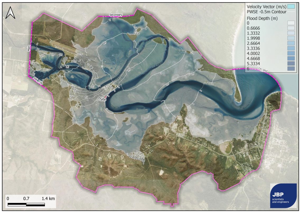
Estimation of the 1 in 100-year peak flood level, depth … Continued