The challenge
Papua New Guinea (PNG) faces significant challenges in maintaining a resilient energy infrastructure due to its vulnerability to various weather-related hazards. The country experiences a range of natural disasters, including heavy rainfall in the highlands, storm surges, coastal inundation, and sea-level rise in coastal regions and islands. Historical data indicates that flooding is the most frequent and economically damaging natural disaster, followed by earthquakes, volcanic activity, and landslides. The Gazelle power system on New Britain Island, which includes Warangoi Hydropower Station and Ulagunan and Kereval Thermal Power Stations, is particularly susceptible to extreme weather events. This project developes a climate resilient energy plan for the network.
Our work
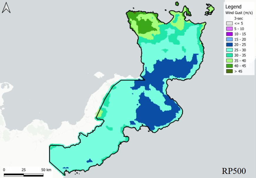
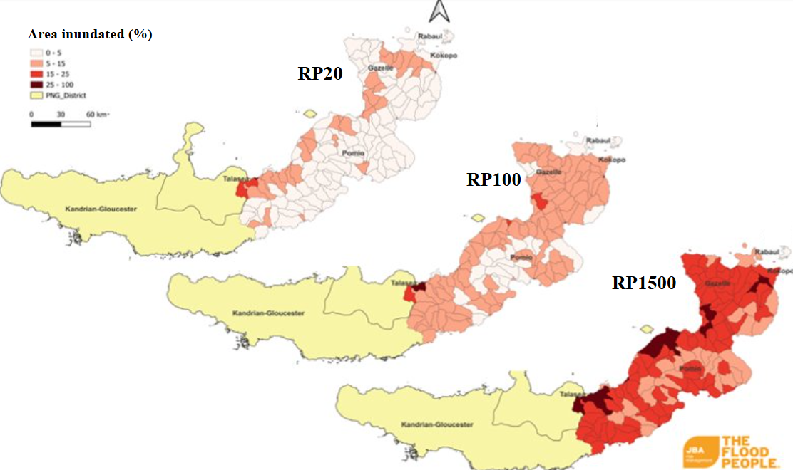
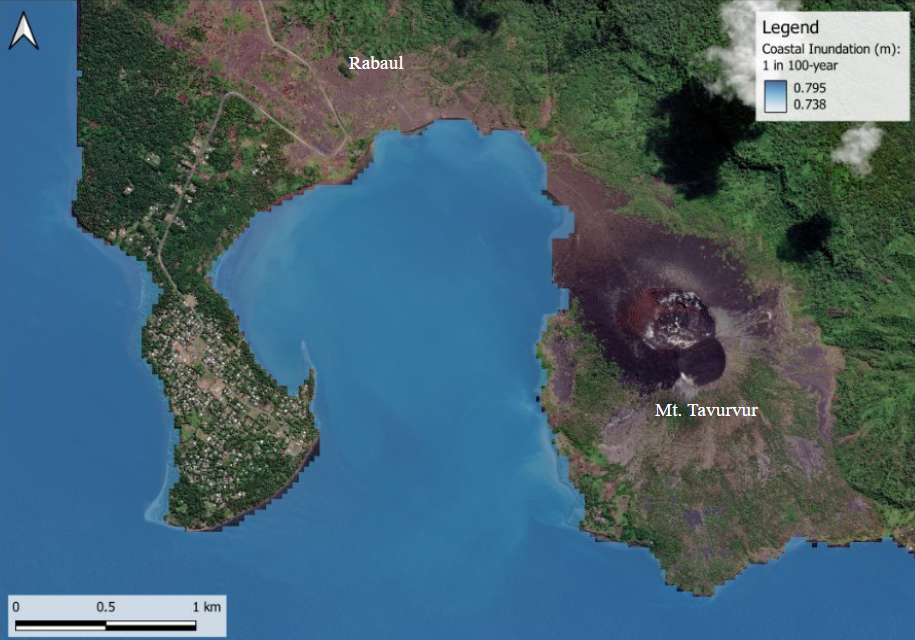
JBP delivered multi-hazard mapping and economic assessments for the project, in collaboration with the World Bank, Cowater, the PNG National Energy Authority, and other local teams and government stakeholders. The work was delivered in two phases. In Phase 1, JBP led the Climate and Natural Disaster Risks Assessment, which included data collection on climate events and the Gazelle grid, hazard mapping (covering flooding, coastal inundation, wind, earthquake, and seismic risks), and risk analysis to evaluate the potential impact of these hazards on energy infrastructure. This phase involved the use of JBA Global flood hazard maps and GIS-based algorithms to extract stream networks and delineate watershed boundaries. Coastal storm surge risk was analysed using COAST-RP modelling, integrating storm surge and tidal conditions at a 30-meter resolution. Wind hazard maps were developed at a 500-meter resolution using cyclone catalog data, with conversion of 10-minute sustained wind speeds to 3-second gust durations for power system design.
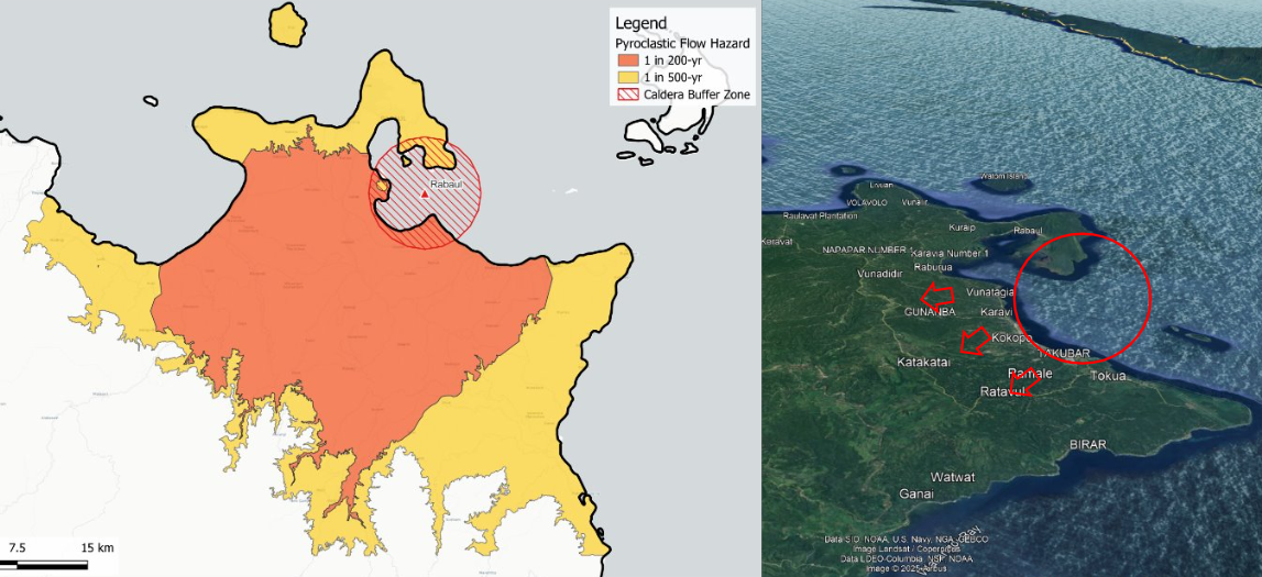
In Phase 2, JBP performed a detailed Assessment of Energy System Vulnerabilities, evaluating the infrastructure and assessing the grid’s exposure to extreme weather hazards, with findings shared in presentations to the Asian Development Bank and project stakeholders. Volcanic hazard assessments were also carried out, using data from the PNG Volcanic Observatory and the Global Volcanism Programme to account for ashfall and lava flow risks to energy infrastructure.