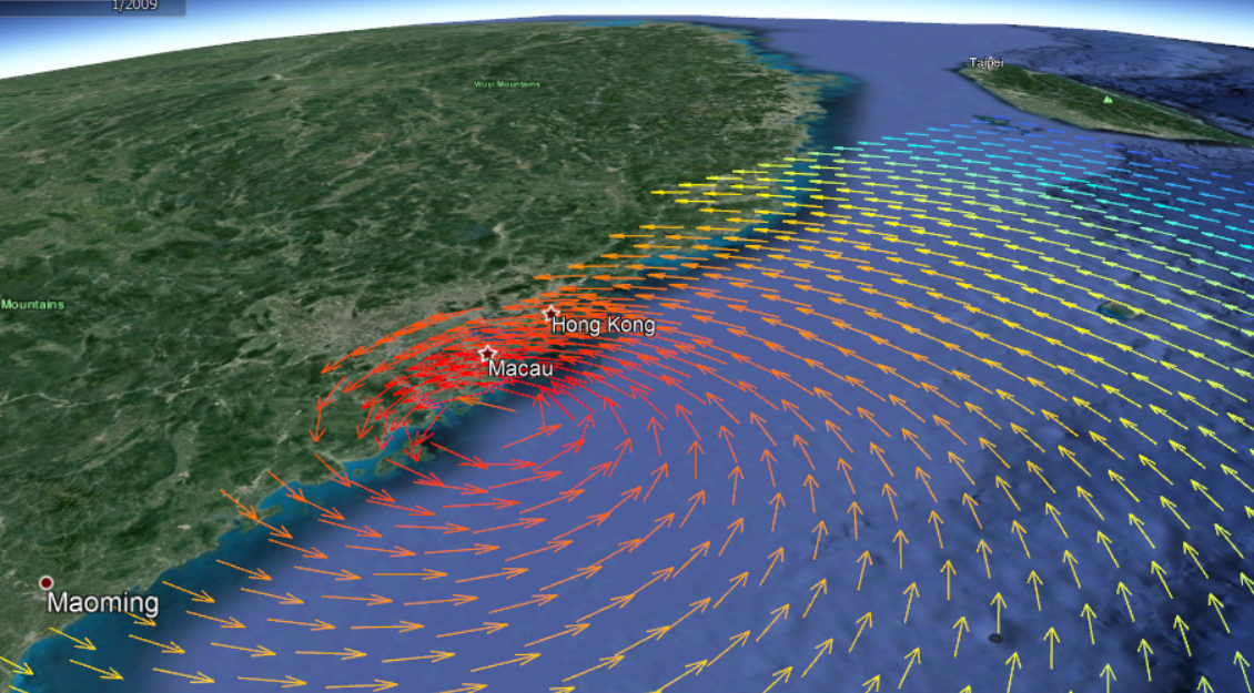
A combined coastal and flood modelling project for Hong Kong. The model used IBTrACS typhoon data to produce design cyclone scenarios. These were modelled through the Delft3D model spanning the South China Sea, calibrated against long-term recorded water levels near Taikoo Shing, north east of Hong Kong Island. The model was used to estimate extreme storm surges for 100 and 500-years, which were combined with high detail hydraulic modelling in Tuflow to estimate inundation