This project was delivered with the JBA Group for the World Bank which involved the assessment and development of actions for flood mitigation in two urban areas in Burundi, Africa.
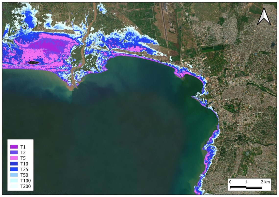
The project included hydrology, hydraulic modelling, urban drainage, risk modelling, water resources and disaster risk management, where we worked in partnership with a technical committee in Burundi to collect data and develop modelling systems for decision making. Our assessment and modelling focussed on Lake Tanganyika, and the impacts on rising lake levels on local communities within Bujumbura and Gatumba. Here regional flood risk has been exacerbated by rising water levels in the lake which has been coupled with recent extreme rainfall. The Flood Hazard Assessment produced estimates of inundation hazards which were used to consider the social and economic losses from a given event, based on local demographic and infrastructural data. It has supported a strategic investment plan, which provides different strategies for intervention for Disaster Risk Reduction, with management reports disseminated back to the World Bank team and Government of Burundi.