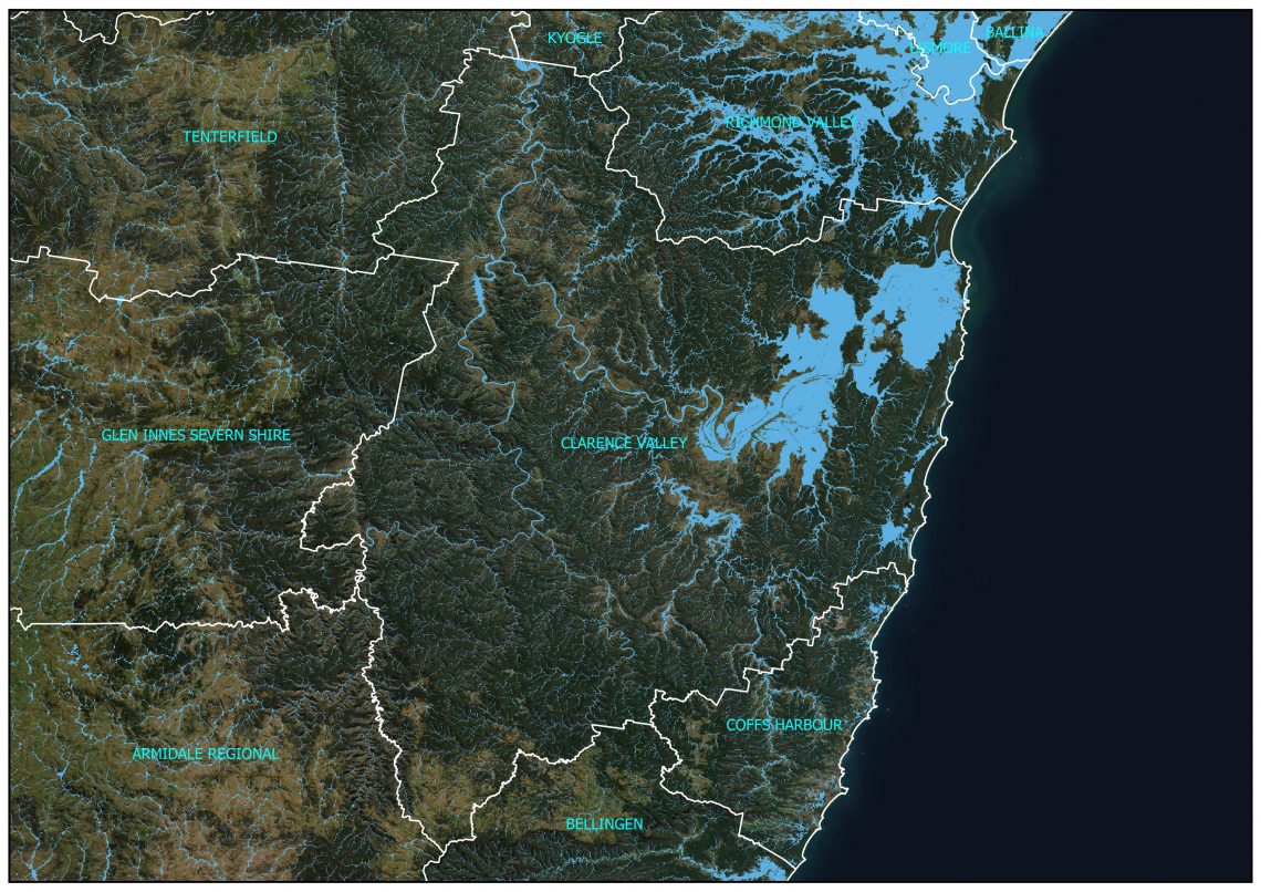
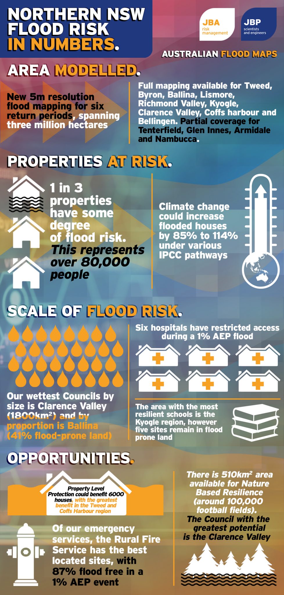
Large-scale flood modelling and mapping now at 5m resolution for six return periods for Northern NSW. The models cover 250km and almost 3 million hectares in area, and includes the Bellingen, Coffs, Clarence, Richmond, Lismore, Ballina, Byron and Tweed Shire Councils in their entirety, in addition to parts of Kyogle, Tenterfield and Glen Innes.
Updates to the Australian Flood Map
These maps are a high-resolution subset of the Australia Flood Map. They were in development between 2018 to 2021, where the region was subject to additional catchment delineation, new hydrological assessment, re-run of the JFlow hydraulic model at a 5m resolution, simulation of pluvial and fluvial scenarios each with six return periods and detailed mapping. The result is a set of new flood maps that span every watercourse between Bellingen and Tweed Heads, in a continuous dataset. The modelling covers 250km (linear) and almost 3 million hectares in area, and includes the Bellingen, Coffs, Clarence, Richmond, Lismore, Ballina, Byron and Tweed Shire Councils in their entirety, in addition to parts of Kyogle, Tenterfield and Glen Innes.
In addition to the new modelling approaches, the Northern NSW flood maps have only been possible due to the release of detailed weather and spatial information by Australian government agencies. This includes the updated Bureau of Meteorology Intensity-Frequency-Duration datasets, the information within the ARR DataHub, and now Geoscience Australia 5m topography.
Getting access
Assess to the Australian Flood Map is through a license. Any region can be accessed, from a national, state, Council or street level.