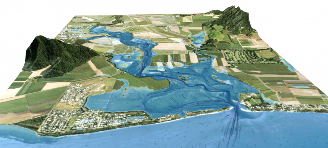
A broad scale hydrology and flood mapping project to perform shire-wide hydrologic analysis, pluvial (rainfall) modelling, fluvial (river) modelling and development of flood maps for the region. Flood maps covered six return periods, from Q20 to Q1500, and were delivered at a 5m resolution throughout the shire for use by Council, disaster managers and first responders.