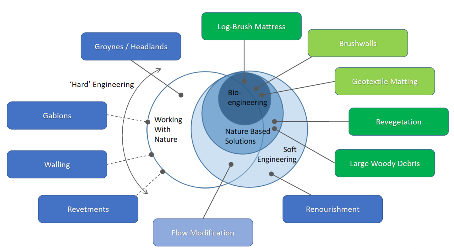
Nature-based coastal resilience measures are being increasingly recommended to stabilise shorelines and protect against coastal inundation. These measures include Nature Based Solutions/ Adaptation (NbS/NbA), Working With Nature (WWN), Soft Engineering, and bio-engineering. These are gaining interest for applications as a substitute for – or in conjunction with – standard coastal protection, due to their co-benefits in habitat creation, increases to social amenity, flood mitigation and climate change adaptation. However, there are limited case studies on the effectiveness of NbS, and a lack of design guidelines for their implementation. Furthermore, a number of technical and planning barriers exist when progressing nature-based approaches from the planning phase to on-ground works. This project has focussed on bridging this gap through new Pilot Projects.
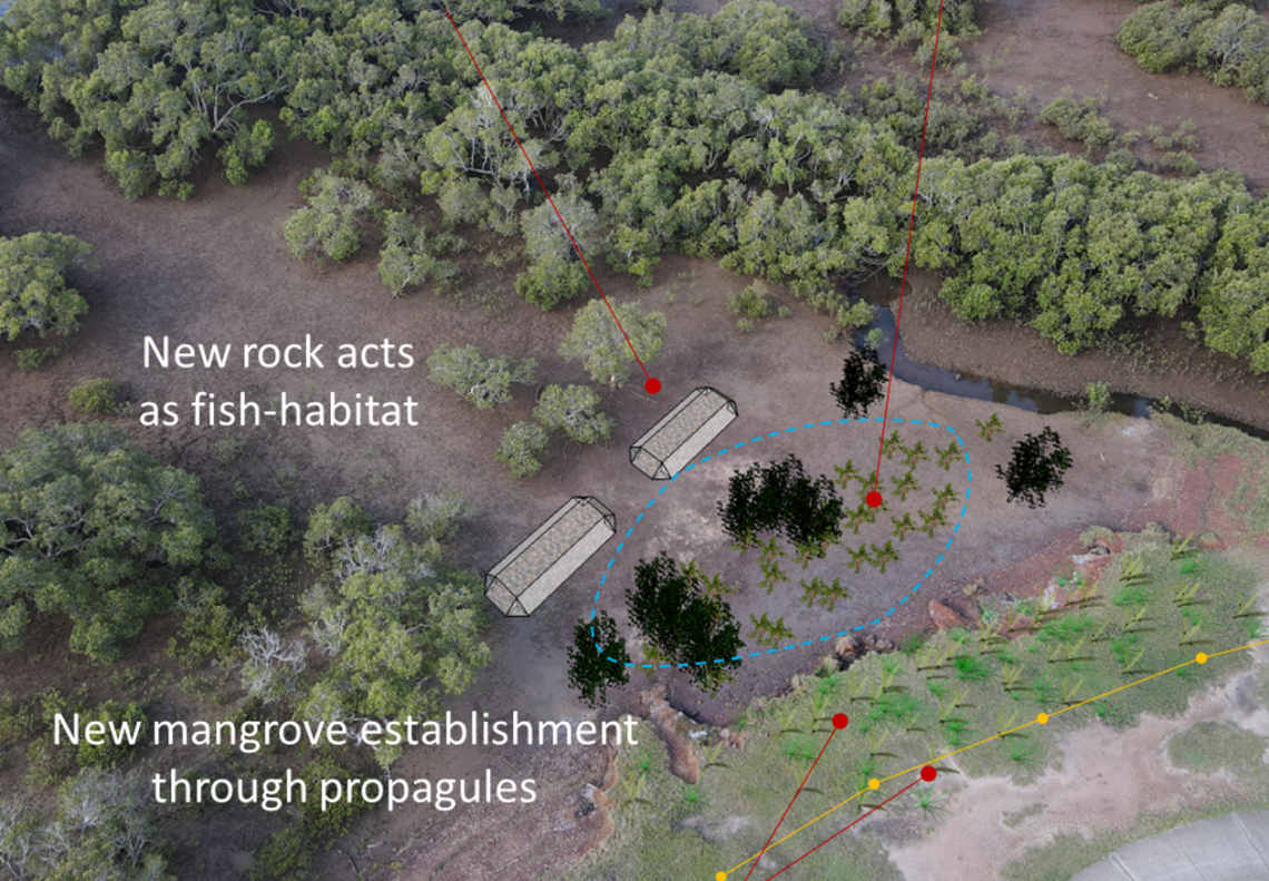
A Living Shoreline Pilot Project has been subject to engineering and ecological design in Moreton Bay, Australia. This project has been developed to identify the challenges, opportunities and risks involved in implementing a coastal protection scheme incorporating NbS. This project is designed to be a Council-led and State Government-supported pilot study to validate the assumptions made within initial assessments. It has been implemented for two sites currently experiencing erosion and coastal inundation hazards.
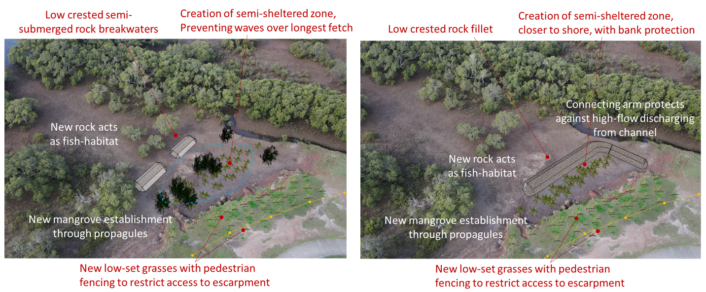
STUDY SITES
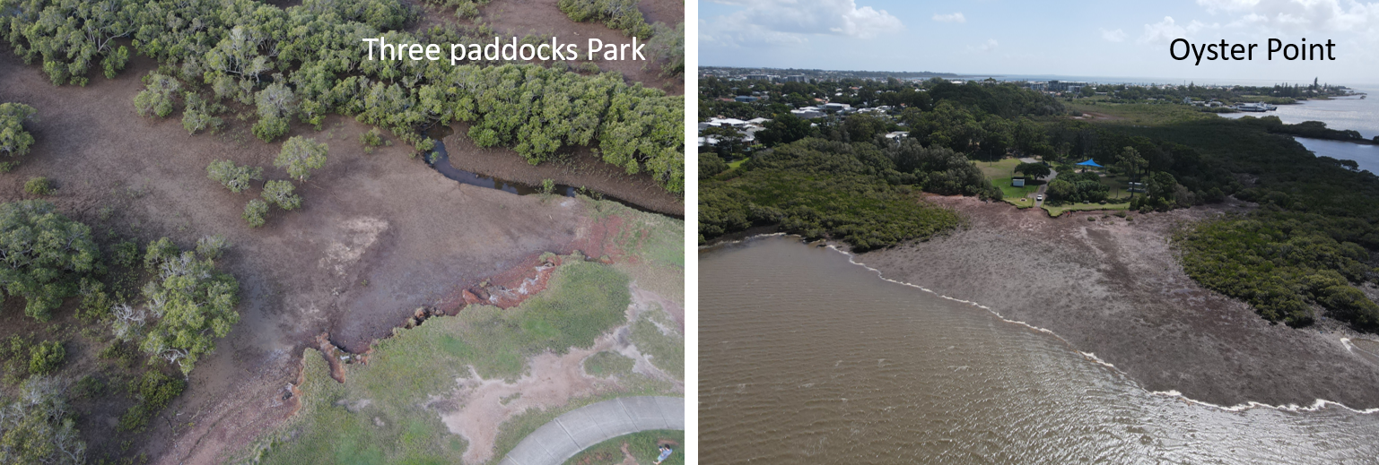
The sites are located at Three Paddocks Park, Birkdale, and Oyster Point Park, Cleveland, QLD. Both are located within Moreton Bay and are offered protection from ocean swell by surrounding islands. However, persistent wind-generated wave conditions have led to ongoing coastal erosion and the development of an erosion scarp approximately 1m high at each. Moreton Bay has a meso-scale tidal range, spanning around 2m during spring tides. Under extreme conditions the study areas can experience a coastal storm surge leading to total sea levels around 1m above the HAT. Additionally, under Queensland State Planning Policies, the areas are considered to be subject to additional sea level rise increases of 0.8m by 2100.
The study has the capacity for multiple approaches to be designed, implemented and evaluated. The ‘textbook’ NbS options investigated during the design process included artificial reefs, mangrove establishment, living seawalls, piling and logjams, oyster reefs, bank regrading and revegetation. Each option has been progressively investigated – subject to a design process, certification and planning checks – with the most suitable option incorporated into the final designs. During this process, the study considered the following:
• If a typical engineering design procedure is suited to the implementation of NbS
• If a standard of protection can be applied to the design
• If there is a need for engineering certification, given the design’s role as an erosion protection scheme
• The planning requirements for the designs
• How ‘textbook’ unit-rates compare to detailed construction cost estimates
• Community response to the new design approach
NEW RESEARCH INTO THE EFFECT OF MANGROVES ON REDUCING WAVE IMPACTS
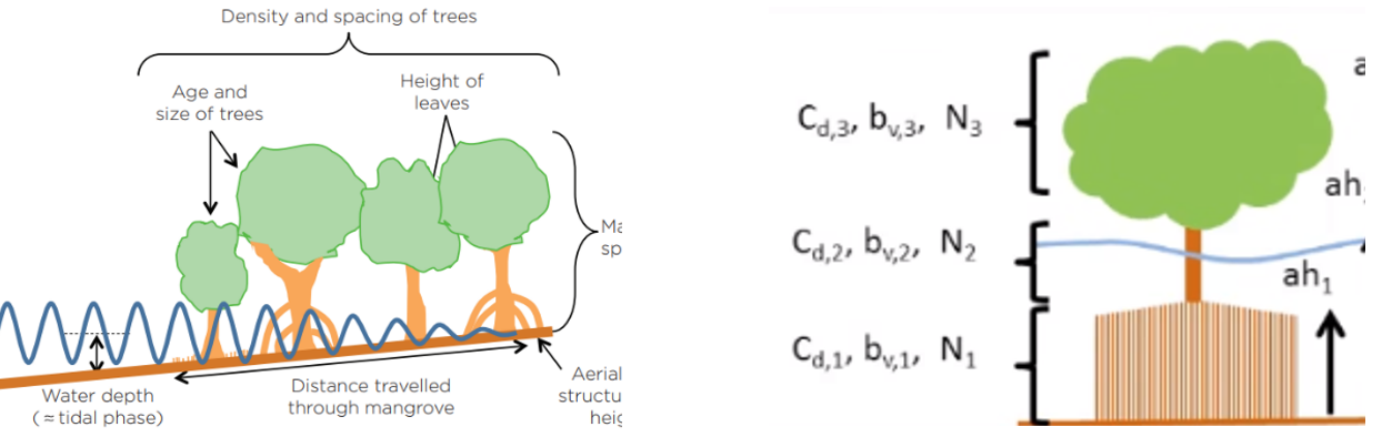
In addition to developing new concept designs, this project has undertaken testing of the protection offered by mangrove forests. Mangroves will reduce wave heights, which can increase the resilience of a coastline or watercourse. This could benefit areas experiencing residual coastal waves, wind-generated waves over wide waterbodies or boat wash. The degree of wave height reduction will depend on the width of the forest, the mangrove tree morphology, water depth, topography, and the incoming wave height. Waves will be more effected by the density of the mangrove forest during high water levels, and the characteristics of aerial roots during low water levels. Both will directly reduce wave energy, in addition to reducing wind speeds over the water surface, and consequent bank erosion.
The XBeach coastal wave and erosion model has been used to assess the level of protection offered by varying widths and density of mangrove forests. It is an open-source numerical model that can simulate the effects of wave dampening through submerged and semi-submerged vegetation such as mangroves and parametrises plant density (N), height (ah), stem diameter (bv), and drag coefficient (Cd). The model was calibrated against field testing conducted by Bao (2011) and Mazda et al (2006) which showed the wave height reduction when passing through mangrove forests can be between 40% and 80% over 100m, with the XBeach model showing around 55% reduction. The new modelling also shows a lower density forest will have a reduction in effectiveness (wave reduction rate drops to 40%) and conversely a healthy mangrove forest with doubled density will reduce incoming waves more than 70%.