This project included coastal investigations, options appraisal and a detailed coastal processes study which spanned the Gladstone council area, supporting a Coastal Hazard Adaptation Strategy (CHAS) and several Shoreline Erosion Management Plans (SEMP) for Turkey Beach, Agnes Water and 1770. This information was used to support new coastal hazard mapping, options appraisal and development of coastal protection and management options.
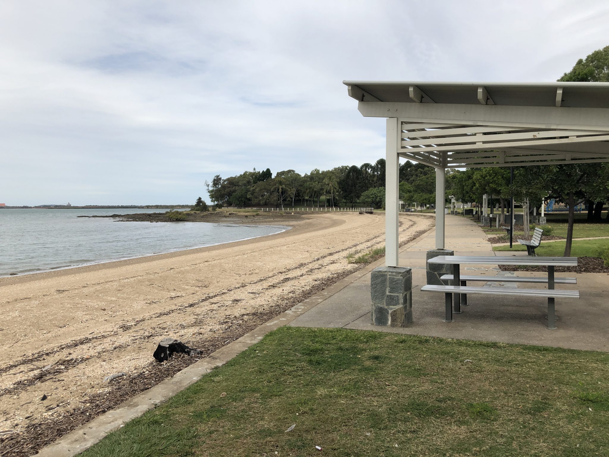
Our coastal engineers first undertook site inspections along the Gladstone coastline, visiting Gladstone, Agnes Water and Seventeen Seventy and assessing beach conditions, eroding shorelines, and 13 coastal defences and important assets (including revetments, seawalls, boardwalks and boat ramps). Visual condition assessments were undertaken to measure the the likely performance of any structure against a baseline standard, using visual indicators to consider the physical, material and structural condition, its performance standard, safety issues, or aesthetic values.
A detailed storm tide study was undertaken for the entire coastline, which included calculation of non-cyclonic water levels using the Skew Surge Joint Probability Method, climatology assessment using international IBTrACS cyclone database, development of a synthetic cyclone database using Geoscience Australia Tropical Cyclone Risk Model, statistical analysis on cyclonic and non-cyclonic joint probability, and estimation of local wave effects using numerical modelling. Storm tides were mapped throughout the coastline, including the Gladstone region.
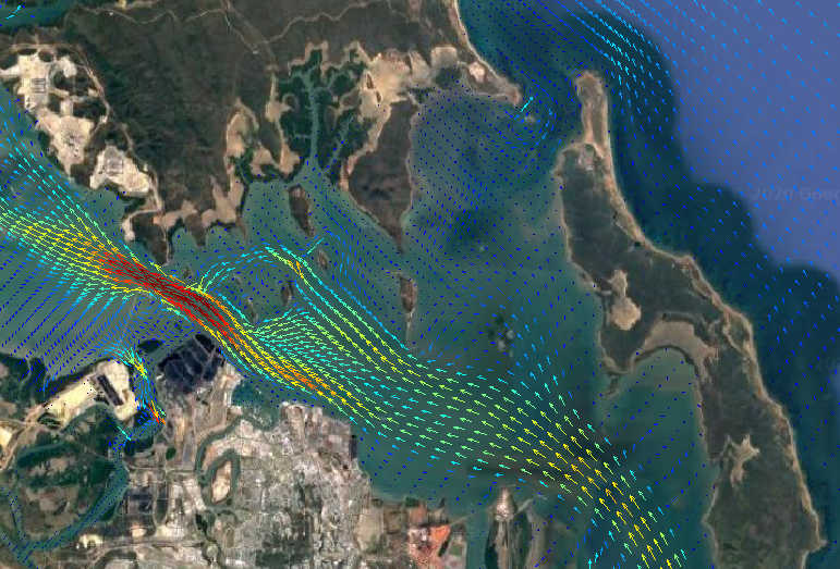
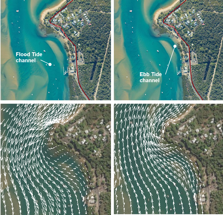
High detail hydrodynamic modelling was also undertaken within Round Hill Creek, which is positioned adjacent to the Seventeen Seventy township. It was run over a spring-neap cycle to map tidal currents and infer sediment transport pathways and erosion zones.
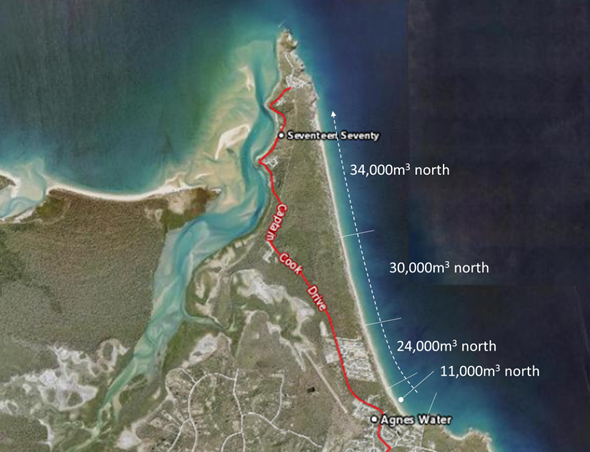
Our JBP Beach Evolution Model (JBEM) was used in conjunction with the estuary tide model and nearshore wave conditions to estimate long-term sediment transport rate between 2000 and 2017. This was calculated at the Agnes Water and Turkey Beach townships. Detailed erosion modelling was undertaken to understand the impact of extreme storms at key beaches. This modelling included present day and future planning horizons (2050 and 2100) and three return periods.
The final steps in the project were to develop the future management and adaptation responses for the region. This used the “Avoid, Monitor, Mitigate, Transition” framework, with included programmes to build capacity and community stewardship, implement new planning, modify infrastructure, and plan for new coastal management and engineering over 39 region-wide and locality specific locations.