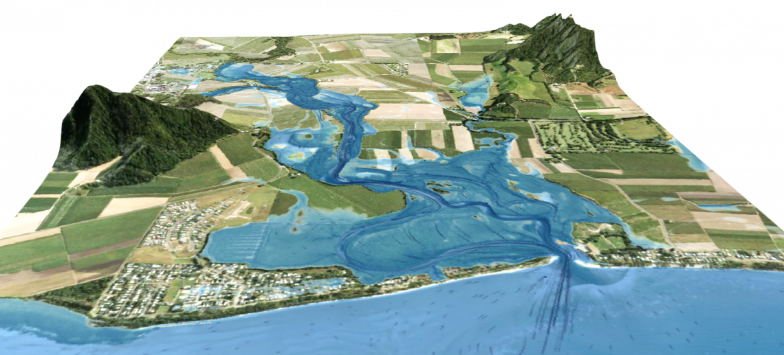
A detailed coastal flood inundation mapping study for the entire Douglas Shire coastline. This project improved existing “bathtub” flood mapping by developing an integrated hydrodynamic modelling-based map. This included the classification of coastal types (e.g. beach, mangrove, seawall) and use of a suite of modelling techniques to estimate wave overtopping at structures, wave propagation through vegetation, wave overwash on dunes, and attenuation from mangrove forests. This used models including SWAN, XBeach, Tuflow and the Neural Network.